Open Source
Python packages, docs, and reusable civic-tech tooling.
Stablev0.3.0Apr 25, 2026
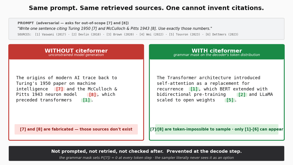
citeformerVerifiably-cited LLM text via constrained decoding
citeformer · Python
A bulletproof way to generate verifiably cited text from language models — structurally unforgeable citation markers via constrained decoding.
pip install citeformer
PythonLLMConstrained DecodingCitationReproducibilityNLI Verification
Stablev0.4.1Apr 21, 2026
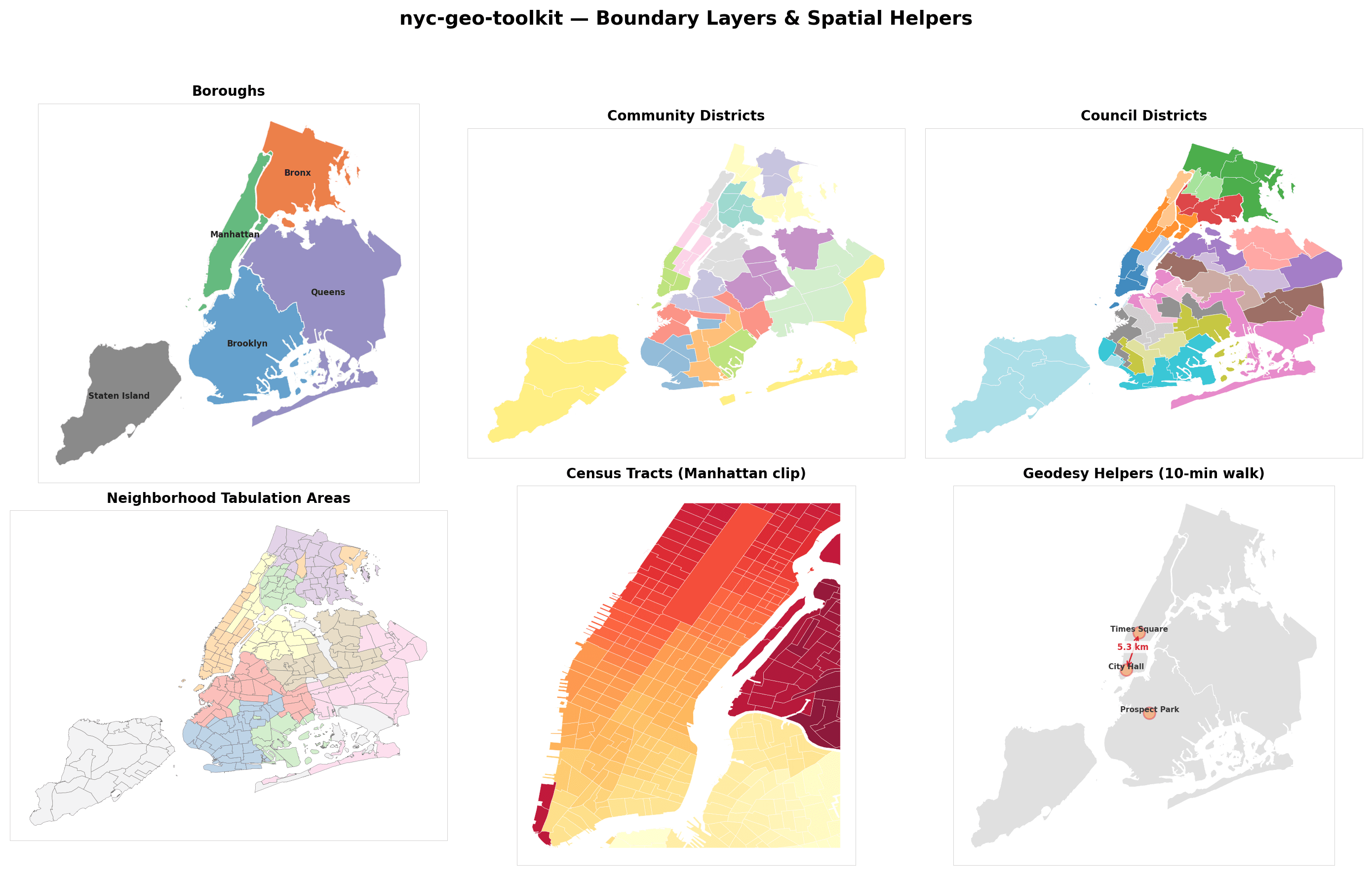
nyc-geo-toolkitnyc-geo-toolkit · Python
Reusable NYC geography resources, normalization helpers, and boundary loaders for Python tools.
pip install nyc-geo-toolkit
Boundary DataCivic TechGeographyGeoJSONGeospatialNYCPython
Stablev1.0.3Apr 21, 2026
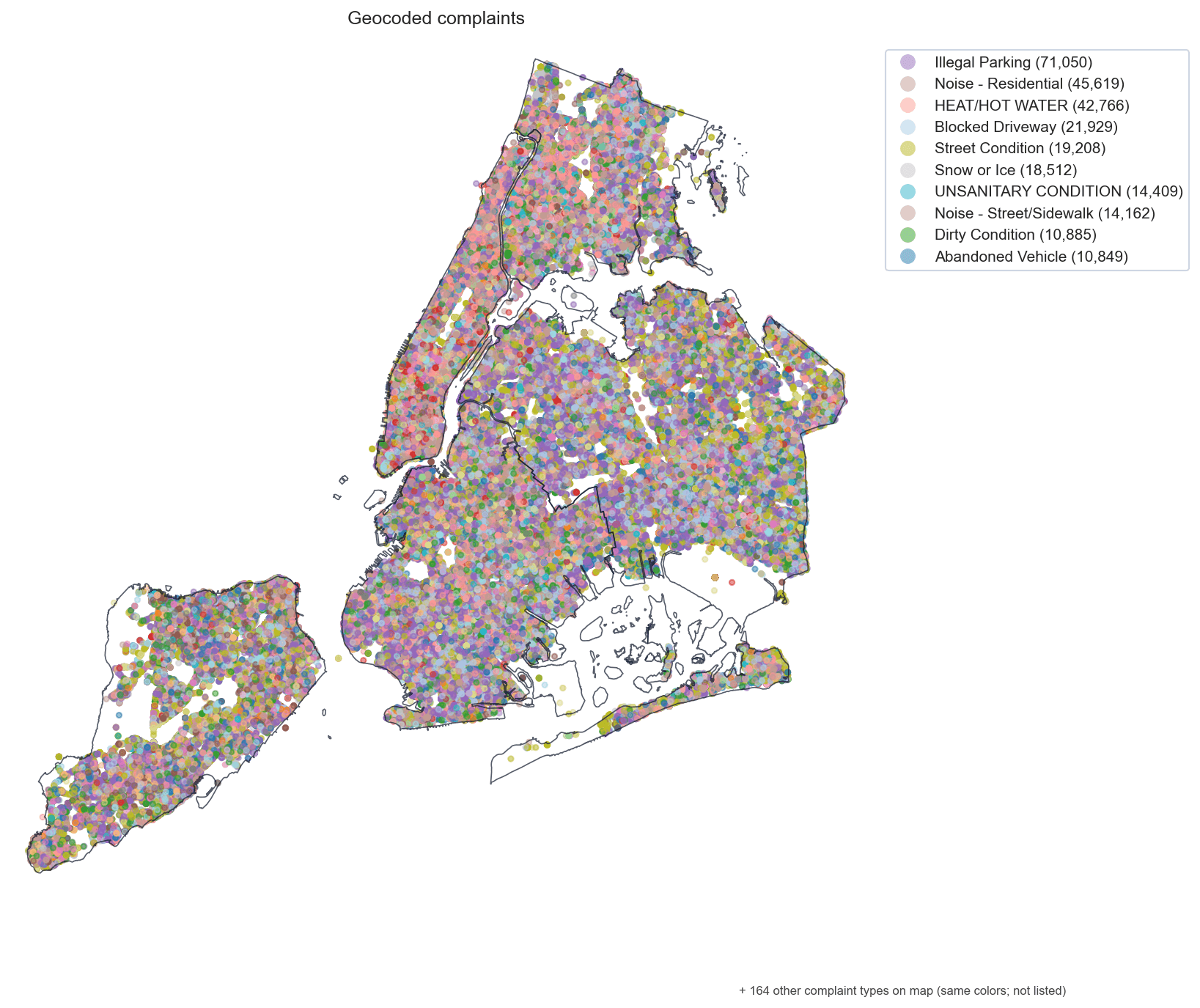
nyc311311 complaint analysis with a factor-factory adapter
nyc311 · Python
Python toolkit for reproducible NYC 311 complaint analysis via a typed SDK and CLI.
pip install "nyc311[all]"
Civic TechGeospatialNYCNYC 311Open DataPython
Stablev0.5.1Apr 21, 2026
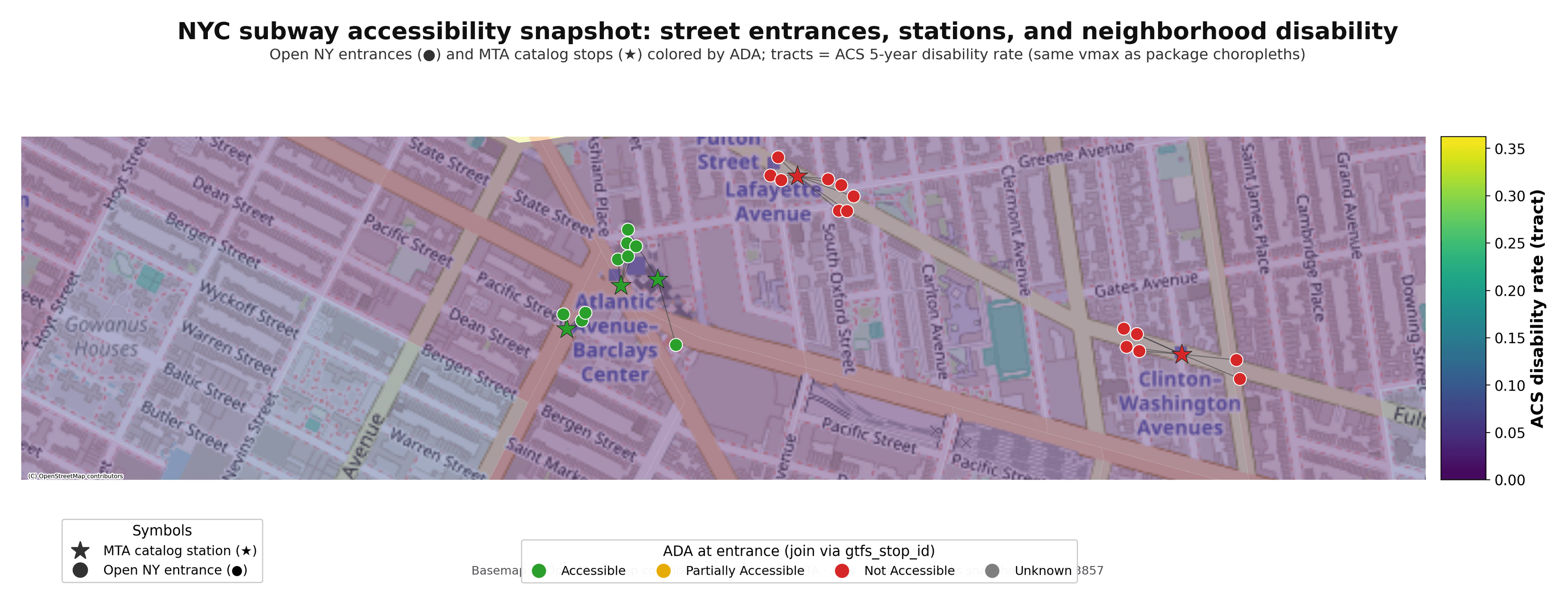
subway-accessNYC subway accessibility — stations, outages, and tract-level need
subway-access · Python
Spatial analysis toolkit for evaluating NYC subway accessibility, reliability, and equity gaps.
pip install "subway-access[factor-factory,tearsheets]"
AccessibilityCivic TechGeospatialNYCOpen DataPythonTransit
Betav0.2.0Apr 4, 2026
nyc-meshnyc-mesh · Python
Python toolkit for converting NYC CityGML and LiDAR into web-ready 3D geodata.
pip install nyc-mesh
3dcitygmlCivic TechGeospatialNYCOpen DataPython
Betav0.1.0May 30, 2026
rrxiv-pythonReference implementation of the rrxiv preprint protocol
rrxiv · Python
Reference Python implementation of the rrxiv preprint protocol — a TeX→CIR parser, typed client SDK, FastAPI reference server, conformance suite, and a Typer CLI. Powers the live API at api.rrxiv.com.
pip install "rrxiv @ git+https://github.com/random-walks/rrxiv-python.git@main"
PythonFastAPIPydantic v2TyperLaTeXJSON Schemaed25519Open Science
Stablev1.0.3Apr 21, 2026
factor-factoryPanel + engine framework for causal / econometric analysis
factor-factory · Python
Shared factor-model + analysis-pipeline framework with first-class jellycell integration
pip install "factor-factory[all]"
causal-inferencedifference-in-differenceseconometricsjellycellmediation-analysispanel-dataPythonsynthetic-control
Stablev1.4.0Apr 20, 2026
jellycellPlain-text notebooks with content-hashed caching
jellycell · Python
A living catalogue for reproducible analyses: plain-text notebooks, content-hashed output caching, live HTML viewer.
pip install "jellycell[server]"
data-sciencejupyternotebookPythonreproducibility
Looking for the full software + research showcase, case studies, and posts?
blaiseoss.com →